
Watch this video to learn how to "read the landscape"
-
- Turn your smartphone into a personal trail guide using live visual AI (such as Google Gemini):
- Open your AI camera app (or use live camera mode) while standing at any point along the ridge.
- Point your camera toward the surrounding mountains, valley, or rock formations.
- Ask: "Gemini, Read the Landscape" or "What geological features and mountain peaks am I looking at right now?"
- The AI will identify the visible landmarks, flora, and mountain peaks in real time.
THE CHATEAUS SOARING TRAIL: AT A GLANCE
-
Distance: 0.4 miles (out-and-back)
-
Estimated Time: 45 minutes
-
Elevation Gain: 268 ft
-
Difficulty: Short but moderate incline
-
Amenities & Connectivity: No bathrooms or facilities | Dogs allowed | Good cell service
-
Trailhead / Parking: 34°05'12.88" N, 116°32'57.81" W
-
Trail End Point: 34°03'40.35" N, 116°32'34.09" W (Connects directly into the Sand to Snow National Monument & San Jacinto region)
WHAT YOU'LL SEE AT THE SUMMIT
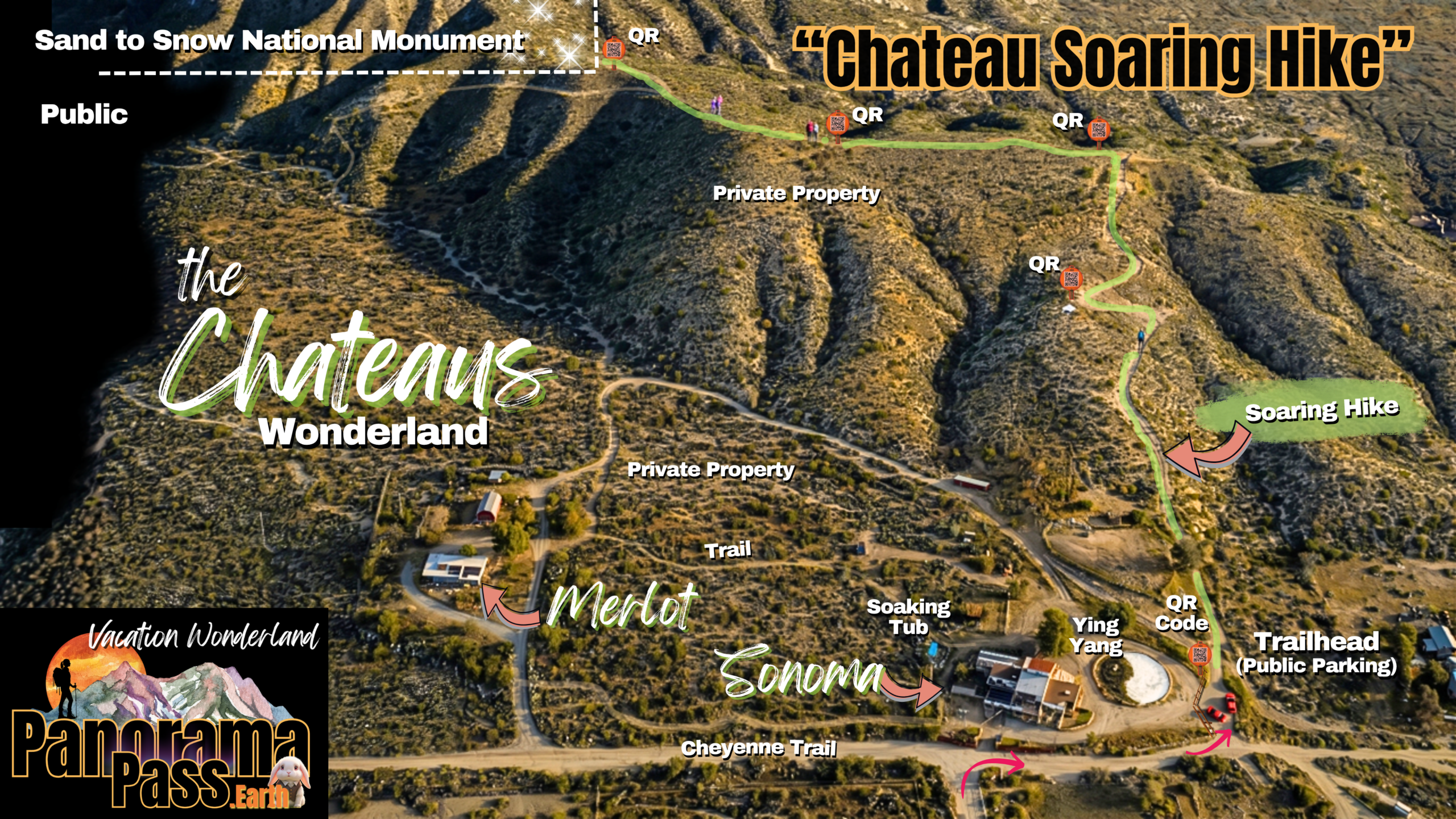
Follow the marked path straight up the hill from the parking area. At the top, you'll be rewarded with a 360-degree panorama:
-
South: San Jacinto Peak towering over the valley.
-
West: The San Gorgonio Mountains—the highest peak in Southern California. The natural corridor formed between San Gorgonio and San Jacinto funnels coastal wind, creating the region’s famous windmill phenomenon.
-
Southeast: The rugged western mountain range framing Joshua Tree.
-
Below: Look directly down to see The Chateaus. The Chateaus below is one of 5 Wonderlands of Panorama Pass. The Chateaus has accommodations for 14 people, a soaking tub, self-guided audio tour, bike riding adventure and more.